Revealed: The places in and around Leamington, Warwick and Kenilworth where people have died after testing positive with Covid-19
and live on Freeview channel 276
For the first time, figures have been released on how many people have lost their lives to the coronavirus in the Warwick district and surrounding areas.
The sobering interactive map has been created by the Office for National Statistics (ONS).
Advertisement
Hide AdAdvertisement
Hide AdIt breaks England and Wales down into more than 7,000 neighbourhoods of about 7,000 residents each.
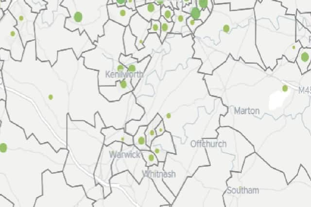

Five out of every six of these areas had seen someone die after contracting Covid-19 by April 17, the figures show.
Locally, Kenilworth has seen 13 deaths, Leamington 11 and Warwick 4, Whitnash 1.
In total, there have been about 56 deaths in the Warwick district and surrounding area.
Advertisement
Hide AdAdvertisement
Hide AdNationally, the worst affected neighbourhood, in Brent, north-west London, had seen 28 people die.
Here are the figures of confirmed deaths for the Warwick district and surrounding areas, as of May 4 2020:
Leamington, Whitnash and Lillington:
Leamington West and Milverton - 4
Leamington Brunswick - 3
Leamington Central - 2
Leamington East and Sydenham - 2
Lillington - 1
Whitnash - 1
Warwick
Warwick South West and Aylesford - 2
Warwick South East, Myton and Heathcote - 1
Warwick North - 1
Kenilworth
Kenilworth East - 5
Kenilworth West - 4
Kenilworth South - 4
Surrounding villages
Balsall Common - 7
Henley-in-Arden and Claverdon - 6
Kineton, Tysoe and Warmington - 3
Cubbington, Stoneleigh and Radford Semele - 2
Kingswood and Leek Wootton - 2
Wellesbourne and Snitterfield - 2
Harbury, Long Itchington and Fenny Compton - 2
Southam, Stockton and Napton - 2
Bishops Tachbrook, Barford and Hatton - 0
From highest to lowest:
Balsall Common - 7
Henley-in-Arden and Claverdon - 6
Kenilworth East - 5
Kenilworth West - 4
Kenilworth South - 4
Leamington West and Milverton - 4
Leamington Brunswick - 3
Kineton, Tysoe and Warmington - 3
Cubbington, Stoneleigh and Radford Semele - 2
Kingswood and Leek Wootton - 2
Wellesbourne and Snitterfield - 2
Harbury, Long Itchington and Fenny Compton - 2
Southam, Stockton and Napton - 2
Leamington Central - 2
Leamington East and Sydenham - 2
Warwick South West and Aylesford - 2
Lillington - 1
Whitnash - 1
Warwick South East, Myton and Heathcote - 1
Warwick North - 1
Bishops Tachbrook, Barford and Hatton - 0