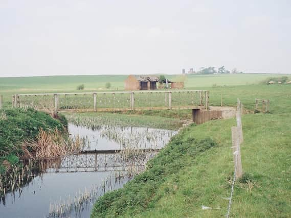
Former Advertiser reporter investigates the legend of the lost township on Rugby's doorstep


Rugby boasts a fine museum with many subjects covered, not least of which is the section devoted to the game that William Webb Ellis so famously bequeathed to the world.
I visited the museum the year before last, and was also fascinated by the exhibition on Tripontium, the Romano-British settlement that once occupied a considerable expanse of land to the north of Rugby.
Advertisement
Hide AdAdvertisement
Hide AdBefore I go any further, I apologise to readers if any of the exhibitions have been changed during my absence. Thanks to Covid and the resulting lockdowns, I haven’t visited my home town for nearly two years, so I may have been overtaken by events.
Much seems to have been collated about Tripontium. But what about the lost township of Cestersover, which in Roman times covered the fields to the north-west of my home village of Churchover?
The English place name ‘cester’ comes from the word ‘ceaster’, commonly indications that the place is the site of a Roman ‘castrum’ meaning a military camp or fort. It can also apply to the site of a prehistoric fort.
Down the years, I have often wondered about the significance of Cestersover. Judging by what few records exist, it was quite obviously a very important place before it disappeared forever below the green fields that now betray few of the secrets that must still lie beneath the soil.
Advertisement
Hide AdAdvertisement
Hide AdFrom what I have discovered, it appears that the settlement was deserted during the late mediaeval period following enclosures of the land, a process that would continue in England up to and throughout the 18th century.
Situated less than a mile from Churchover, Cestersover stood on a slight rise overlooking the River Swift. From records we learn that in 1460 and1467, patents were granted to a London draper named Henry Waver.
He appears to have been a native of Cestersover, and enclosed 500 acres of the surrounding land.
It then seems that this began the process of decline, the manor house soon falling into disrepair, and the grounds for the most part converted to sheep pasture.
Advertisement
Hide AdAdvertisement
Hide AdIn 1776 a chronicler by the name of Stukeley recorded a ditch, a chapel converted into a barn, and across the valley, fishponds. ‘Old Town Field’ and ‘Town Meadow’ appear on ancient maps of the area.
Until 1955, aerial photographs clearly showed a comprehensive pattern of roads and crofts, but with no house sites visible. Crofts are small fields, usually adjoining a house.
Pictures also revealed an area of somewhat indistinct earthworks surrounding the site of the manor house and chapel. South from this, a single street runs in a dead straight line, with crofts regularly spaced to either side.
It is clear that some of these crofts were superimposed on earlier arable fields. A William de Waver was granted a market here in 1257 and this planned expansion may have been the result of this commercial activity.
Advertisement
Hide AdAdvertisement
Hide AdBy 1332, however, there were only seven taxpayers. But because of ploughing since that time, the earthworks have now almost completely disappeared. In 1963, the laying of a pipeline across the site surprisingly did not produce any evidence for the mediaeval village.
In 2001, English Heritage considered all archaeological remains to have been destroyed by continuing arable cultivation, and that the site should no longer be considered of national importance.
However, that decision has subsequently been challenged by experts who claimed that the site was still well preserved, despite ploughing, and that the decision to de-schedule may have been made without all of the facts being available.
Nevertheless, what is known still presents more questions than answers. For example, the evidence of a small triangular widening of the main street, just south of the moat, could even be the site of the market granted to either Cestersover or Churchover in 1257.
Advertisement
Hide AdAdvertisement
Hide AdBearing in mind that the right to hold a market was traditionally granted by the reigning monarch, this seems to suggest that either one or both of these settlements were once places of considerable importance.
And that takes us back to Tripontium. Were there once two major Roman towns facing each other across the Swift valley, strategically positioned next to the vitally important Watling Street?
And if so, how did they escape the ravages of Boudicca’s marauding army of Celts which passed by on its way to catastrophic defeat at the hands of the legions in the great battle of Mancetter in 55AD, just 15 miles to the north-west?
It seems that the mystery of Cestersover is destined to remain unsolved.
Advertisement
Hide AdAdvertisement
Hide AdThis lost township, which was a flourishing centre when the land where Rugby now stands was just a Celtic hill fort, must undoubtedly have been of considerable importance.
And it will possibly never reveal its secrets, this place that for so many centuries has lain hidden just below the surface of that grassy hillside above the valley of the River Swift.
Footnote: John Phillpott’s book about his days as a reporter on the Rugby Advertiser during the 1960s titled Go and Make the Tea, Boy! was published last year.